


As-Built, Construction, Topographic and LiDAR Surveys in Toronto
As-built surveys, construction layout, topographic surveys for additions and infill, and SLAM LiDAR scanning on Toronto sites.
Mon-Fri 8am-5pm, Sun 9am-4pm

- 28+Combined Years Of Experience
- 795+Projects Completed
When we’re surveying Toronto job sites, the work usually centres on an as-built survey: measuring what was actually built so the project team can compare it with the design before the next stage starts. Geo Vision Surveying Inc provides as-built surveys, construction layout, topographic surveys and SLAM LiDAR scanning for contractors, builders, designers, engineers and property owners in Toronto. We don’t have a Toronto office. We travel to Toronto projects from our base in Hagersville and book field visits around your construction schedule.
Surveying Toronto projects: as-built, layout, topographic and LiDAR
As-built surveys for Toronto construction
An as-built survey records the actual position and elevation of features once they’re in place: footings and foundation walls, structures, curbs, sidewalks, grades, services and other site features. The measurements give your engineer, consultant or project manager a record of existing construction to compare with the drawings. Timing matters on busy city sites. Anything that will be backfilled, paved over or built on should be measured while it’s still exposed, so tell us early which items your contract, engineer or municipality wants shown. → As-built surveying services
Construction layout and grade checks
We set out building corners, footings, gridlines, offsets, curb and sidewalk lines and elevations from your approved, client-provided drawings, so excavation and forming crews have marks they can build from. On tight urban lots, where new work has to tie into existing buildings, roads and sidewalks, checking layout and elevations before concrete is placed saves costly fixes. → Construction surveying
Topographic surveys for additions, site plans and infill
Before an addition, a new infill house or a site change can be designed, your architect or designer needs accurate existing conditions. When surveying Toronto lots for design, a topographic survey records ground elevations and the visible features on the property: the existing house and neighbouring structures, driveways and walkways, retaining walls, trees, catch basins, and curbs and sidewalks along the street. Your designer uses this information to draw the site plan and work out grades for the new building. Buried utilities aren’t visible at the surface; locate marks are surveyed if the scope requires buried utilities to be shown. → Topographical surveying
SLAM LiDAR scanning of existing buildings
For renovations, additions and complex interiors, SLAM LiDAR scanning captures a dense 3D point cloud of existing conditions while the operator walks through the space. It’s useful when drawings of an older building are missing or out of date. Available deliverables and file formats are confirmed in the quotation. Point-cloud processing, CAD drawings and any scan-to-BIM modelling are included only where expressly agreed. → SLAM LiDAR scanning
From our field files: as-built fieldwork in Toronto
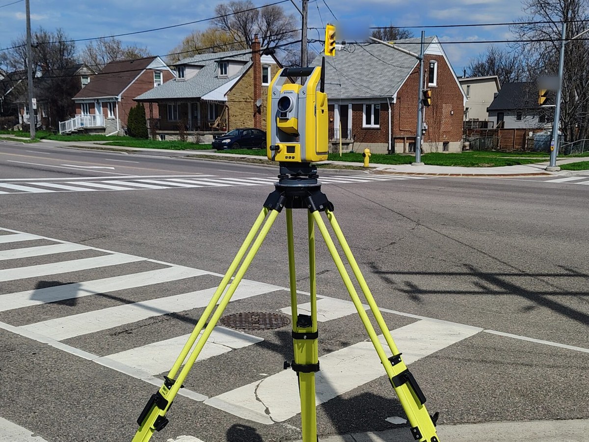
Geo Vision Surveying Inc has completed as-built survey fieldwork in Toronto, documenting existing constructed conditions in a busy urban setting. Surveying Toronto streets means working around traffic, pedestrians, nearby structures and restricted instrument positions, so the job depends on suitable survey control, careful instrument placement and checked measurements. We describe that work in our blog post, As-Built Surveying in Toronto. See our Toronto case studies: as-built survey fieldwork in Toronto, a control survey in Toronto and curb and sidewalk construction layout in Toronto.
Planning a survey on a Toronto site
Surveying Toronto sites takes a little more planning than rural work. When you book, let us know about parking or loading restrictions, gate or hoarding access, the site contact, and which trades will be working at the time. For as-built work, tell us which items need to be measured and when they’ll be accessible, because the best time to survey a footing or a service is before it’s covered.
Toronto infill grading: where our survey fits
For new infill houses, the City of Toronto sets its own Lot Grading Requirements for Infill Housing. We don’t prepare grading plans or issue lot grading certificates. What we provide is the measured field information the people preparing and certifying the plan work from: existing elevations, curb and road elevations and the positions of existing features, plus as-constructed elevations later in the job if they’re needed. Requirements change, so confirm the current rules with Toronto Building or your consultant.
What to send for a Toronto quote
- The site address and the nearest intersection
- What the survey is for: as-built, construction layout, topographic survey or SLAM LiDAR scanning
- Current drawings: architectural, structural or site drawings, or the engineer’s list of as-built items
- Who asked for the survey (contract, engineer, consultant or the City) and what it must show
- The construction stage, the date the work will be accessible, and your deadline
- Access notes: parking, hoarding, gates, site contacts and working hours

Toronto surveying FAQs
What is included in an as-built survey?
We measure the agreed items as they were actually built, for example footing and wall positions, elevations, grades and services, and deliver a drawing or data file that shows them against the design.
When is an as-built survey required?
Usually when a drawing, engineer or contract asks for confirmation of what was built, often before the next stage of work or at project closeout. Your contract documents set the exact requirement.
What is SLAM LiDAR?
SLAM LiDAR is a walk-through laser scanner that maps a building while it moves, producing a 3D point cloud of the space without setting up at every point.
What file formats do you deliver for LiDAR scans?
Available deliverables and file formats are confirmed in the quotation. Point-cloud processing, CAD drawings and any scan-to-BIM modelling are included only where expressly agreed.
Do you prepare lot grading plans or lot grading certificates?
No. We provide the measurements and survey data. The grading plan and certificate come from the Grading Consultant the City requires.
Do you have an office in Toronto?
No. We’re based in Hagersville and travel to Toronto projects by appointment.
Related pages
As-built surveying · Construction surveying · Topographical surveying · LiDAR surveying · As-Built Surveying in Toronto (blog) · Projects · All service areas · Contact us
Nearby areas: Surveying in Oakville · Surveying in Burlington.
Toronto case studies: As-built survey fieldwork · Control survey · Curb and sidewalk layout.
Planning a project in Toronto?
For surveying Toronto as-builts, layout, topographic surveys or scans, send us the address, your drawings and what the survey is for, and we’ll follow up with a scope and quote.