


Surveying Services in Hagersville, Ontario
Building layout before the pour, topographic surveys, grade checks and as-builts for homes, additions and site work in Hagersville and Haldimand County.
Mon-Fri 8am-5pm, Sun 9am-4pm

- 28+Combined Years Of Experience
- 795+Projects Completed
Geo Vision Surveying Inc provides construction layout, topographic surveys, grading measurements and as-built surveys for homeowners, builders and contractors in Hagersville and the surrounding Haldimand County area. When surveying Hagersville sites, we focus on residential and small commercial projects, such as new homes, additions, garages, shops and farm buildings, and site work on rural and in-town lots, and on getting the right measurements to the people who design and build, at the stage they need them.
Surveying Hagersville builds, from layout to as-built
Building and construction layout
Layout is the step where the approved design becomes marks on the ground: stakes, pins, nails and paint that the excavation and forming crews build from. On a tight residential lot, with fences, an existing house and a changing trench, good layout lets crews check their work before any concrete arrives. → Construction surveying
Topographic surveys
During design, a topographic survey records existing grades, structures, trees and other features on the lot, so your designer plans with real measurements rather than estimates. → Topographical surveying
Grading measurements
Grading and elevation checks can use the same survey references as the layout. We provide the measurements and survey data. Grading and drainage design by an engineer or designer isn’t included in our surveying service. → Grading surveying
As-built surveys
When footings, foundations or services are in place, an as-built survey records what was actually built, so it can be compared with the plans before the next stage. → As-built surveying
Drone and SLAM LiDAR for larger or complex sites
On larger rural parcels, drone surveying can map open ground efficiently where conditions and airspace allow. SLAM LiDAR scanning captures detailed 3D existing conditions of buildings and structures. → Drone surveying · LiDAR surveying
On site in Hagersville: building layout before the pour
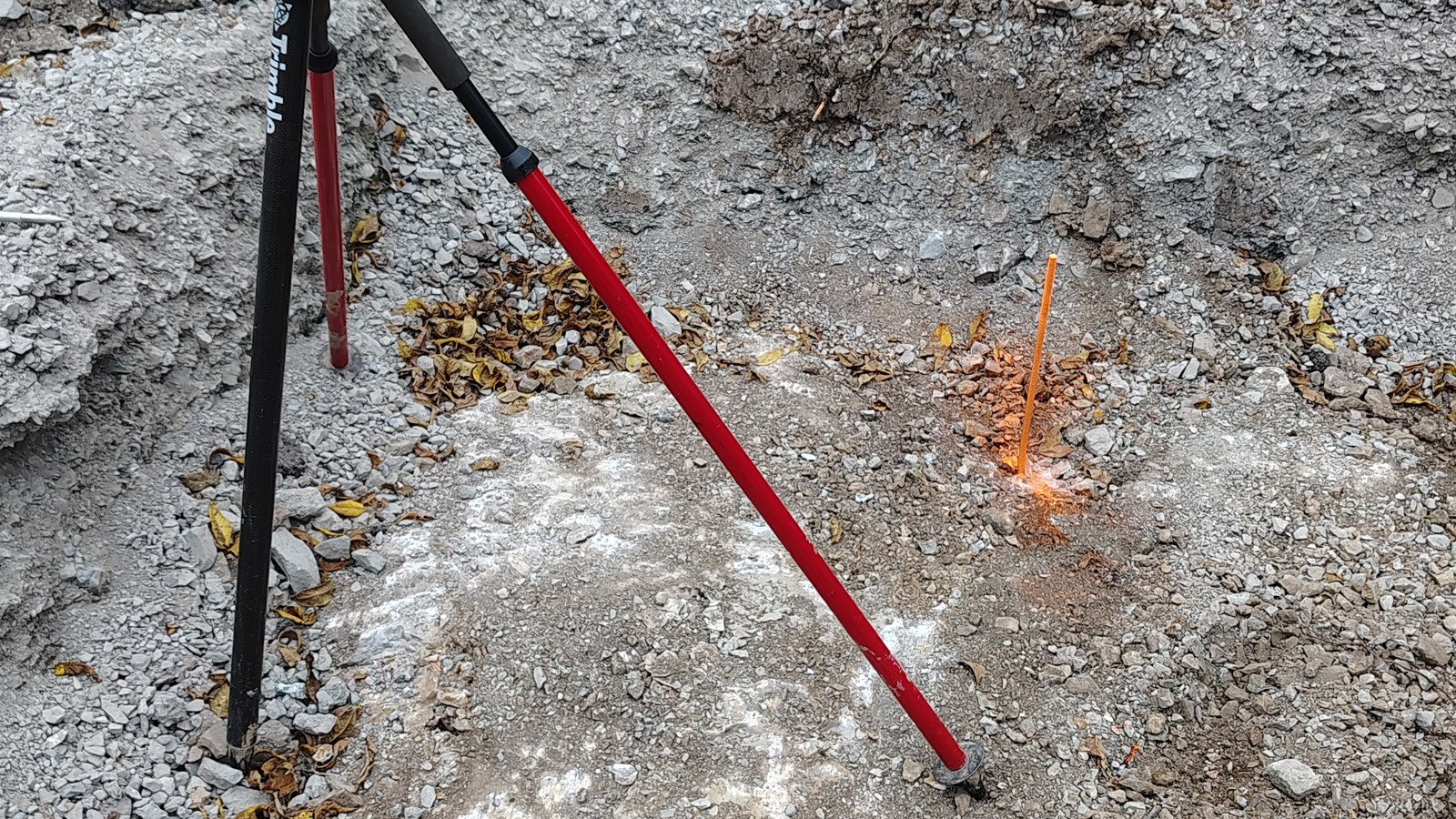
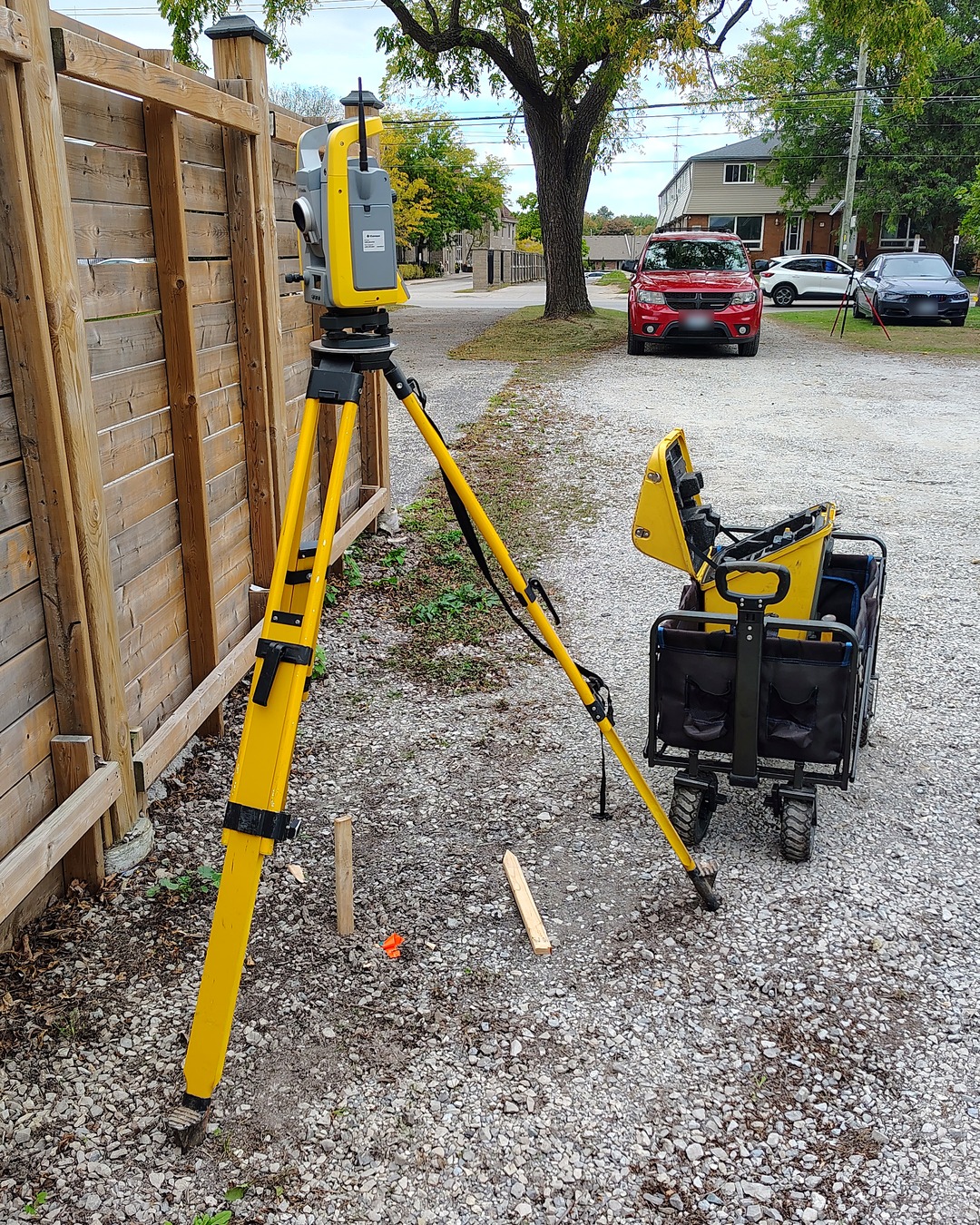
On a residential site in Hagersville, Geo Vision Surveying Inc used a robotic total station to place layout marks around fences, the existing building and an excavated footing trench. A stake marked the instrument setup, and a pin with orange paint in the trench gave the forming crew a fixed reference to check against the design. Moving a stake takes minutes, while moving a footing after the pour can take days. Read the full story: Building Layout in Hagersville: Getting the Footings Right Before the Pour.
See our foundation layout in Hagersville.
Haldimand County permit and grading information
Haldimand County asks for a to-scale site plan with building permit applications, including a copy of a survey or plot plan showing the lot measurements, yards, proposed building location, setbacks and site services. Rural properties also show septic system distances and well or cistern locations. For many residential and commercial developments, the County’s Site Plan Approval process reviews grading and drainage. Before surveying Hagersville lots for a permit, check the current requirements with Haldimand County Building and Planning. We provide the measurements that support these drawings. We don’t design grading or drainage, and no survey guarantees permit approval.
What to send for a Hagersville quote
- The site address, and the town or area within Haldimand County
- The approved drawings: site plan, foundation plan and any engineer’s grading plan
- What you need: layout, topographic survey, grade check or as-built
- Your excavation and concrete dates
- Site access notes and the on-site contact
- Where the survey files should go (owner, builder or designer)
Hagersville surveying FAQs
When should building layout be booked?
Once the drawings are approved and the excavation date is known. Layout goes in before digging, and footing marks are checked before concrete.
Does layout replace my architect’s or engineer’s drawings?
No. Layout transfers approved, client-provided drawings to the ground. It isn’t design or an engineering approval.
Can you check my finished grades?
Yes. We measure finished grades and elevations and can compare them with the grading plan your designer prepared. The design itself isn’t part of our service.
Do you work outside Hagersville?
Yes. Along with surveying Hagersville sites, we serve the surrounding Haldimand County area. Send us the address to confirm.
Related pages
Construction surveying · Topographical surveying · Grading · As-built surveying · Projects · Blog · All service areas · Contact us
Nearby areas: Surveying in Simcoe · Surveying in Brantford · Surveying in Hamilton.
Building in Hagersville?
For surveying Hagersville projects, send us your drawings, the address and your schedule, and we’ll come back with a scope and quote.
Geo Vision Surveying Inc · Serving Hagersville and Haldimand County