

Geo Vision Surveying IncAbout Us
About Geo Vision Surveying Inc
28+ years of combined global surveying experience, providing construction layout, topographic, as-built, LiDAR and drone surveying services across Southern Ontario.
Mon-Fri 8am-5pm, Sun 9am-4pm
28+
Combined Years Of Experience
795+
Projects Completed
755+
Satisfied Clients
Team of 3
About Us
About Geo Vision Surveying
Geo Vision Surveying Inc is a trusted provider of high-precision geomatics and digital mapping services in Southern Ontario. While our firm is modern and technology-driven, our technical leadership brings over 28 years of global construction/engineering survey experience to every project. We specialize in residential, commercial, and public sector developments, delivering the foundational data that ensures engineering and construction projects are built on solid ground.

Our Story
Our Journey
The journey of Geo Vision began with a vision to modernize the way spatial data is captured for the Canadian construction and engineering industry. Our technical founder, Lloyd Haughton, established the firm to bridge the gap between traditional measurement techniques and advanced digital mapping. With experience spanning major infrastructure projects across multiple countries, we bring a unique global perspective and a wealth of engineering knowledge to every site in Ontario.
Lloyd Haughton
Owner & Technical Founder

Who You Work With
Our Team
At the core of Geo Vision Surveying Inc is an agile, specialized team of professionals united by a shared passion for precision. Our team works as a tight-knit unit, and every client need is met with a custom-tailored solution. We use project-specific field checks and office review to support reliable measurements and deliverables. Under the technical direction of Lloyd Haughton, we maintain a “white-glove” approach to every project, providing direct communication and expert oversight from the initial quote to the final deliverable.
Team of 3
Direct communication and expert oversight from the initial quote to the final deliverable.

Innovation
Our Technology
Innovation is the engine that drives us. Recognizing the critical role of technology in modern infrastructure, Geo Vision Surveying Inc is equipped with industry-leading tools. From robotic total stations, GPS/GNSS, high-density LiDAR sensors to state-of-the-art UAV (Drone) systems, our technological arsenal enables us to tackle the most challenging projects with confidence and efficiency.
About Lloyd Haughton
Lloyd Haughton is the owner and technical founder of Geo Vision Surveying Inc, a construction and engineering surveying firm based in Hagersville. Geo Vision Surveying Inc brings 28+ years of combined global surveying experience, including major infrastructure projects in several countries, to builders, contractors, engineers and property owners across Southern Ontario. Lloyd leads the firm's construction layout, topographic, as-built, grading, monitoring, SLAM LiDAR and drone survey work, and writes about practical surveying for construction projects.
Our Equipment
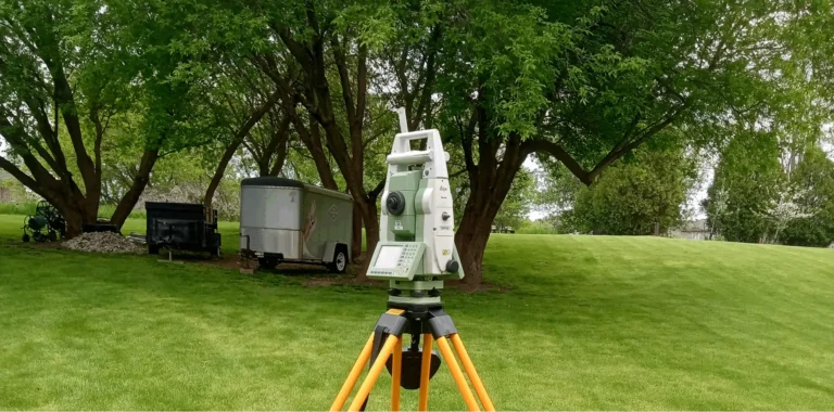
Every survey is only as reliable as the instruments behind it. Geo Vision Surveying Inc measures with professional survey equipment that is maintained and checked regularly, and we choose the right tool for each site rather than forcing every job into one method.
- Trimble survey instruments for building and foundation layout, elevation checks, as-built measurements and monitoring, where tight positioning matters.
- Spectra survey equipment for grade work and quick elevation checks on site.
- LiGrip O2 SLAM scanner for walk-through 3D capture of buildings, interiors and complex sites, delivered as LAS point clouds and DWG drawings.
- DJI drones for aerial mapping, topographic surveys, stockpile volumes and construction progress imagery.
- Digital level for precise elevation checks and settlement monitoring readings.
Our instruments are calibrated every year.
Experience
Geo Vision Surveying Inc brings 28+ years of combined global surveying experience to every project. Our technical founder, Lloyd Haughton, has worked on major infrastructure projects in several countries, and leads every project personally, from the first quote to the final deliverable.
- Construction and engineering surveying focus: layout, topographic, as-built, grading, monitoring, SLAM LiDAR and drone surveys for construction projects.
- Insured: Geo Vision Surveying Inc carries general liability insurance.
- Drone certified: our drone work is carried out by a certified drone pilot.
- Worksite safety: our field team is fully trained in worksite safety.
- Engineering partners: we work alongside AM Engineering and Arik Engineering Limited. The engineering firm handles the engineering side of a project, such as grading certificates, while Geo Vision Surveying Inc provides the surveying.
Where We Have Worked
Our Experience
With more than 28 years of global surveying experience, our team has delivered projects across Hagersville, Hamilton, Brantford, Simcoe, Niagara, Brampton, and Toronto. From construction, topographic, grading, LiDAR and drone surveys for infrastructure clients including Sierra Bridge, Gedco Excavating, Nanticoke Refinery and Grid Utility Construction, we bring the same commitment to precision and reliability to every client — whether commercial, residential, or municipal. Our dedication to accuracy and detail ensures results you can trust.
Where we have delivered projects

What We Do
Scope of Our Services
Geo Vision Surveying Inc provides construction, topographic, as-built, monitoring, volume and earthworks, LiDAR and drone surveys.
What our clients say


Every project at Geo Vision is driven by our motto
Our Commitment
“Precision in Every Point.”
This commitment to unmatched accuracy and detail is the standard we hold ourselves to in every task. Whether it’s a large-scale commercial development or a detailed topographic map, our clients can trust Geo Vision Surveying Inc to deliver results that meet and exceed expectations.